Detail and Level Survey (DA Surveys)
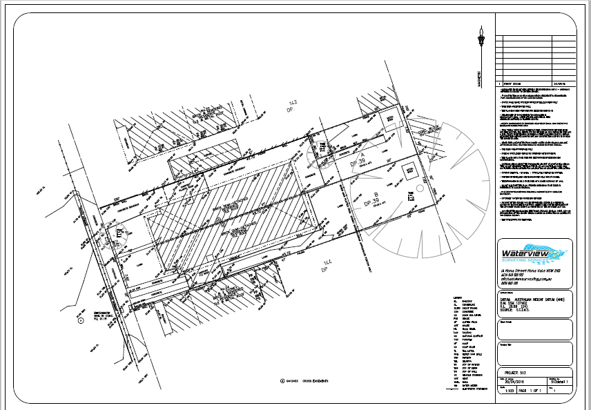
A Detail and Level Survey (DA Survey) is the first point of call in the DA process required by Councils. This survey is the basis on which the Architect/Designer starts the design process and may also be used by other consultants such as Engineers and landscape Designers.
Some of the features your Detail and Level Survey displays:
- the topography of the land,
- the orientation of the land relative to North,
- Levels relative to Australian Height Datum (AHD)
- Approximate position of your property boundaries (unless boundary definition is requested)
- Easements and other rights affecting or benefitting the land
- All built structures and significant landscaping features upon the land
- Significant trees on and abutting the land
- Adjoining buildings and private outdoor areas which may be affected by proposed development.
We can also produce elevation and sectional drawings, internal floor plans and shadow diagrams.We are happy to tailor the Detail and Level Survey to cater for any additional requirements.Detail and level surveys are provided in both hard copy and digital CAD and PDF formats compatible with your designer’s software.
Contact Waterview Surveying Services for a free quotation today.